Last Updated on September 26, 2022
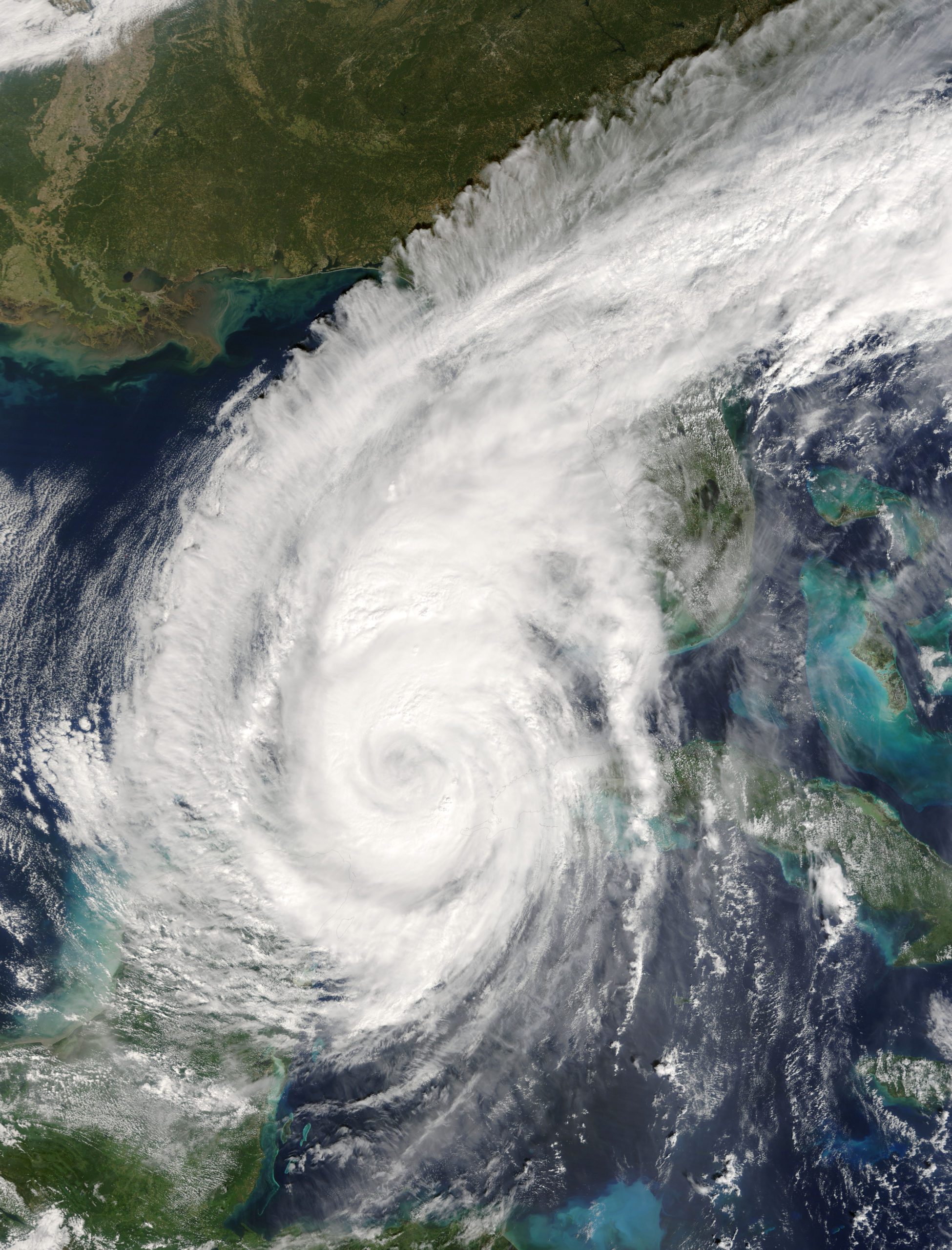
Let’s face it—Florida gets a lot of bad press. From news of the coronavirus pandemic to annual hurricane scares, I often get calls from friends up North asking if we are OK down here. Despite the stories they may hear, there are record numbers of people flocking to the Sunshine State. Now that travel is starting to return, and COVID-19 vaccines are widely available, people are on the move. I don’t just mean taking the family to Disney World or escaping the snow for a sandy beach vacation. I mean they are selling their houses, packing up their stuff and moving south!
According to the state’s Office of Economic and Demographic Research, about 329,717 new residents settled in Florida between April, 2020, and April, 2021. Move.org reported Florida was the No. 1 destination for Americans who relocated in 2020, based on a variety of metrics. Other sources reported Florida was in the top three relocation destinations.
Of course, this means there are many people who have never experienced a tropical storm or a hurricane. It means, if you’re a native, you may have a lot of people asking you what to do and how to prepare. For all of you Florida newbies, welcome! And here’s my best advice:
DON’T BE SCARED, JUST PREPARE.
This applies to longtime locals, too. We tend to downplay storms because, “We’ve lived through them.” But preparing is key for everyone who lives in Florida, whether you’re at the beach or inland.
So how do you prepare? Start by finding the information you need specifically for you and your family. If you live in a flood zone, you will prepare differently than someone who does not. If you are a caregiver, think about what everyone in your care might need if a storm hits. Being fearful prevents you from taking action. If you prepare before the storm arrives, your mind will be at ease, and you can wait it out without worry.
How do you prepare for a hurricane? Answer these questions to get started:
- In which county do you reside? (Watches and warnings are issued by county name.)
- Are you in a flood zone or an evacuation zone? (Zones are labeled A, B, C or red, yellow, green. Each county is different. Know your zone!)
- If you must evacuate, where is the closest shelter? What are their rules? Do they allow pets?
- If you go to a shelter, what are their COVID-19 requirements? Do you need or have extra masks and hand sanitizer?
- How much water do you drink? How much non-perishable food will you need for three days?
- What will happen if your house loses power for three days? A week?
- Do you need a generator? Do you have gas for the generator and your car?
- Do you have a prescription to fill in advance?
- Write down what other things you would need to know if a storm hit.
Now go find the answers to your questions BEFORE the first storm arrives. Check https://www.ready.gov/kit for more details about building a hurricane kit.
Hurricane FAQ:
- Hurricane season in the Atlantic Basin runs from June 1 to November 30, which correlates to when tropical systems are most likely to form. However, tropical storms and hurricanes have formed in every month of the year.
- The World Meteorological Organization (WMO) creates the list of storm names. The lists are recycled every six years with new names added only when a name is retired due to severity or impact. There are 21 rotating male and female names on each list.
- In past years, if more than 21 storms formed in a season, the Greek alphabet was used for names. New in 2021, there is a secondary, alternate list of names that will be used if more names are needed.
Once a tropical storm forms, or is about to form, the National Hurricane Center issues its official forecast cone track. We call it a “cone” because it usually looks like one; but essentially, it’s a forecast path for the storm.
WHAT IS THE “CONE?” 
This forecast gets updated every six hours based on satellite and radar data and, when available, information from the Hurricane Hunters flying into the storm. That means every six hours a new cone is drawn on a map based on the latest data.
The forecast cone track shows where meteorologists believe the storm’s center will move over the next five days. Data from the last five years determine the size of the cone each season. That’s based directly on forecast accuracy. A more accurate previous five-year period leads to a smaller-shaped cone. Less accuracy over the last five years leads to a wider cone.
The forecast is based off computer-generated models of the atmosphere. These models often pop up on TV or online, even though interpreting them isn’t a simple task. Sometimes they are nicknamed “spaghetti models” because the lines can look like a pile of spaghetti. Forecast models vary tremendously in structure and complexity. It’s not as simple as following a single line on the map and knowing what the storm will do.
Keep in mind, the cone contains the probable path of the center of the storm. It does not take into consideration the size of a storm. Hurricane conditions can occur well outside the edge of the forecast cone.
AMY’S TOP 5 HURRICANE WEBSITES
Federal Alliance for Safe Homes
Amy Sweezey joined Growing Bolder in 2020 as a Special Projects reporter, producer and writer after retiring from a 25-year broadcast meteorology career. She has authored two children’s books about weather and created two weather workbooks for elementary-school students. Amy and her husband live in Central Florida with their three children.


